
Flood Drainage Study over a subbasin in Gujarat
The catastrophic impact the flood caused to both life and property is known to all 1 . So, any industry before the establishment of any project wanted to rule out all the possibility of the risk caused by the flood. Satyukt Analytics, an expert in microwave remote sensing was contracted for computing:
- Design storm scenarios of various return periods
- Standard Project storm (SPS)
- Probable Maximum Precipitation(PMP)
- Portable Maximum Flood (PMF)
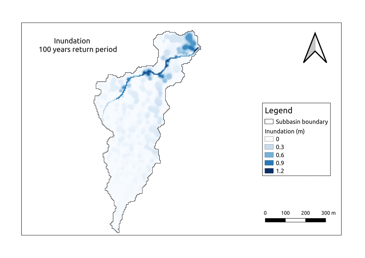
The study has been performed for various return periods say 2, 5, 10, 50 and 100. The figure depicts the inundation depth map for the 100 return period over a basin. It is observed from the map that inundation depth varies from 0 to 1.2 m and the highest values are close to the stream. This kind of study will help in understanding the past events and present trend, also aids in better planning and management.


