
Monitoring Crop burning in Punjab and Haryana using Remote Sensing
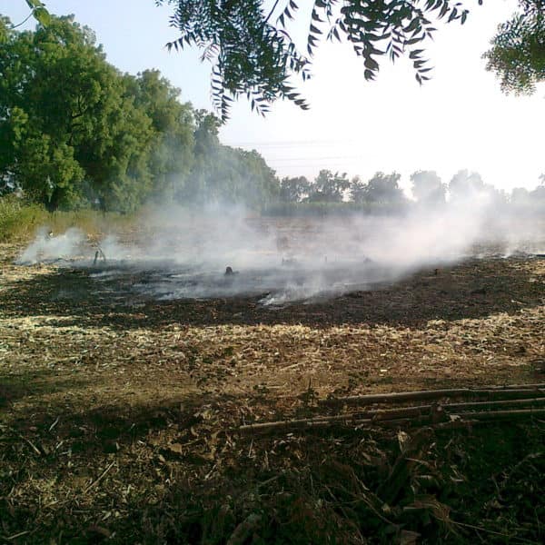
Crop burning is the process of deliberately burning crop residues post harvesting. It is widely practiced by farmers in the states of Punjab, Haryana and Uttar Pradesh in spite of government restrictions, mainly because of the lack of resources for scientific management of waste. The mass burning occurring in these states during the harvesting season is detrimental to the environment affecting land, water and air quality in the region as well as surrounding regions.
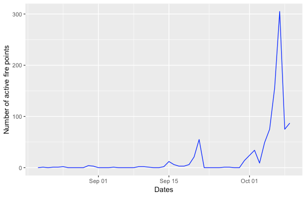
NASA’s Active fire data1 was used to monitor the number of active fire points occurring in Punjab and Haryana over September and October 2018 (Fig. B). A steep increase in the number of active fire zones was noticed during the last week of September and the first week of October, which is ideally the harvesting season for paddy in the region. This data can thus be used as a possible indicator for the number of crop burning events in the two states.
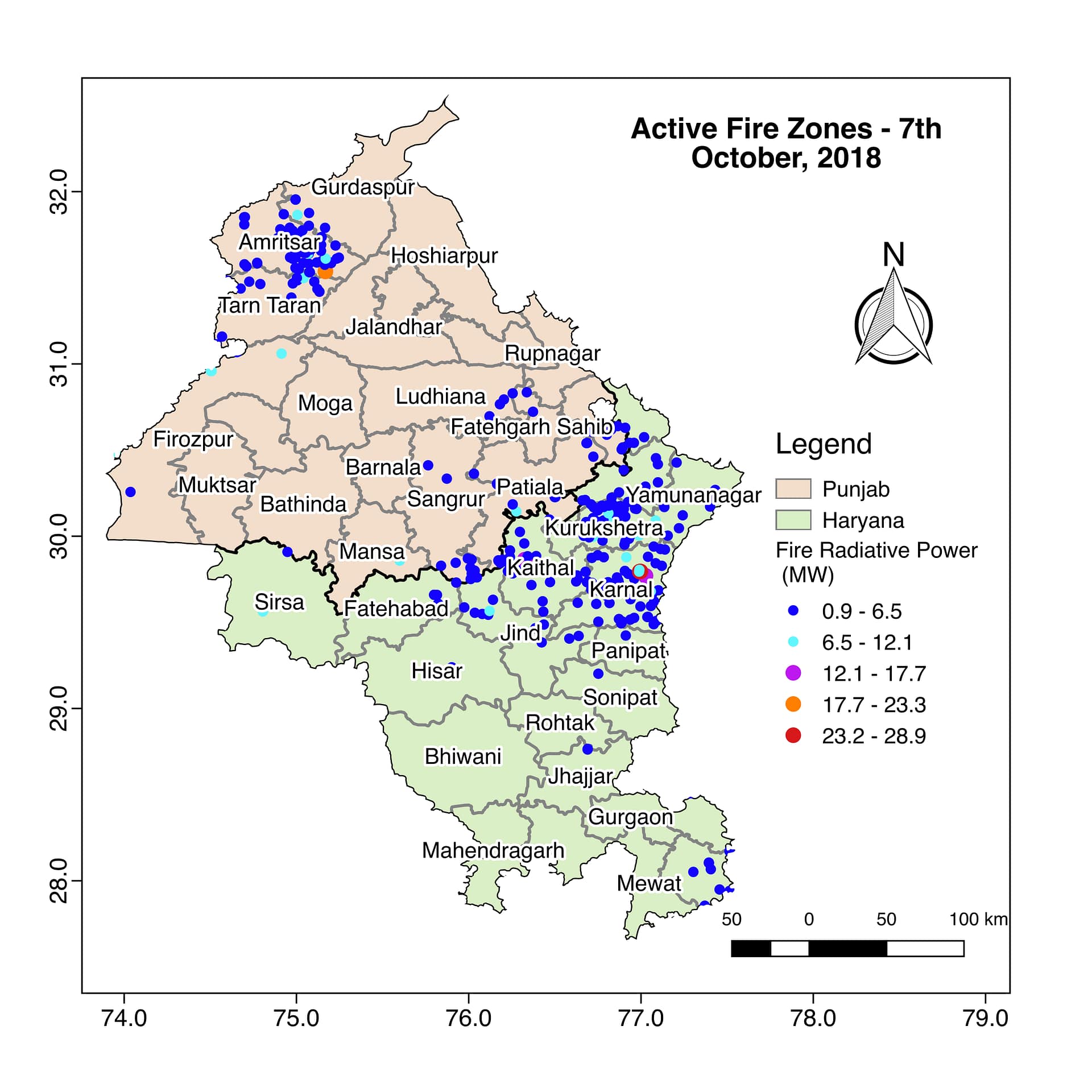
A daily maximum of 305 active fire points was noticed on 7th October 2018 and the radiative power of the fire ranging between 0.9 MW to 28.9 MW was mapped in (Fig. A). The Fire Radiative Power is a measure of the output radiant heat of a fire and can further be used to estimate the biomass consumed in the process. Remote Sensing data can be used for better management of natural resources and for detection of possible causes of naturally occurring forest fires as well.


