
Vegetation Health Monitoring over a farm in Karnataka
India is experiencing an increase in widespread drought in recent decades due to climate change1. This not only affects crop productivity, but also exacerbates groundwater extraction that cause conflicts among people, increasing migration and economic stress.
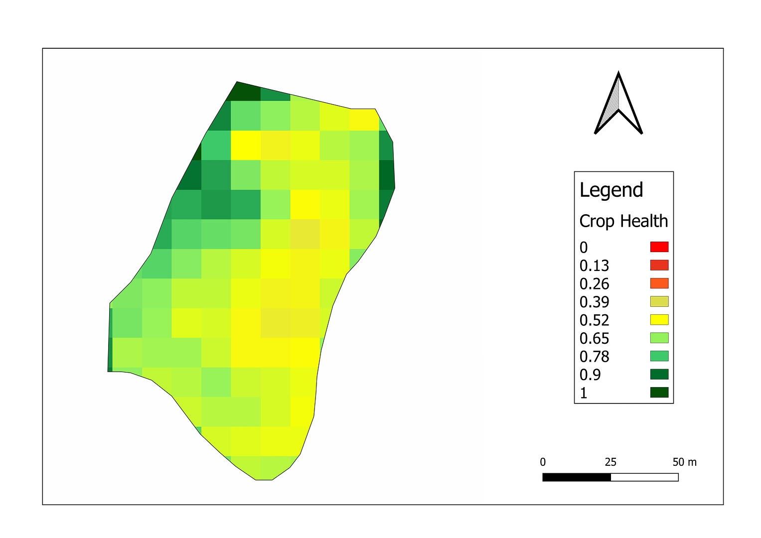
A satellite based Vegetation Condition Index (VCI) is being used for the estimation of crop health as well as for monitoring drought conditions around the world. The main advantage of VCI based satellite products is that they not only provide high resolution spatial data at near real time but also do not require in-situ meteorological data 2.
The above map shows the VCI map of one farm in Kerala at a spatial resolution of 10 m.
Satyukt Analytics Pvt Ltd is capable of monitoring drought with the help of multi-temporal satellite imagery to mitigate drought.
Reference
- Tyalagadi, Manjunatha & Gadgil, Alaka & Krishnakumar, Gaddam. (2015). Monsoonal Droughts In India – A Recent Assessment. Papers on Global Change IGBP. 22. 10.1515/igbp-2015-0013.
- Quiring, S. M., & Ganesh, S. (2010). Evaluating the utility of the Vegetation Condition Index (VCI) for monitoring meteorological drought in Texas. Agricultural and Forest Meteorology, 150(3), 330–339. doi:10.1016/j.agrformet.2009.11.015


