
Visualizing satellite soil moisture data – Ambhas
Ambhas an interactive web portal developed by Satyukt analytics to study and analyze the trends of environmental variables with the help of current and historical data. On the portal, we have groundwater level, rainfall data, and soil moisture.
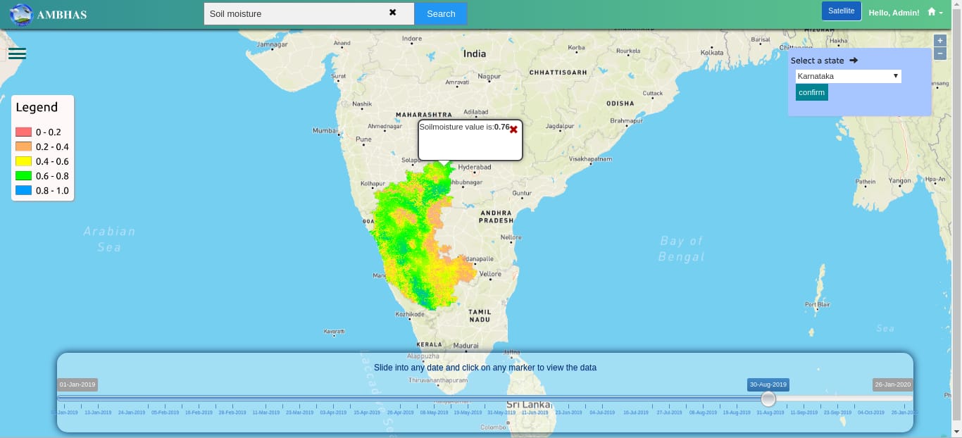
In the last post, we have discussed viewing the groundwater level data. Here in this post, we’ll have look at soil moisture data. On the portal, users can select the soil moisture as the product from the dropdown. After that, users can select the states available to view the data.
For example, you selected Karnataka from the available states. As a result, soil moisture data of Karnataka will be added to the base map. Also, we have added a slider to view the older data. For that, change the slider into a specific date and the map will be updated with that specific date. Apart from these users can also view the of a specific location by clicking on the map.


