
High resolution soil moisture data can help to identify irrigation requirement in small sized farms
First published on December 05, 2018
The Agricultural land is diminishing at a fast rate due to urbanization and climate change. Mostly in India, rain-fed agriculture is practiced and hence the knowledge about precipitation, soil moisture, and other agrohydrological parameters would benefit farmers to implement precision irrigation and thus can optimize the usage of water. As the landholdings are below 2 hectares and the sizes of the fields are small, high-resolution data is required to monitor these factors field-wise.
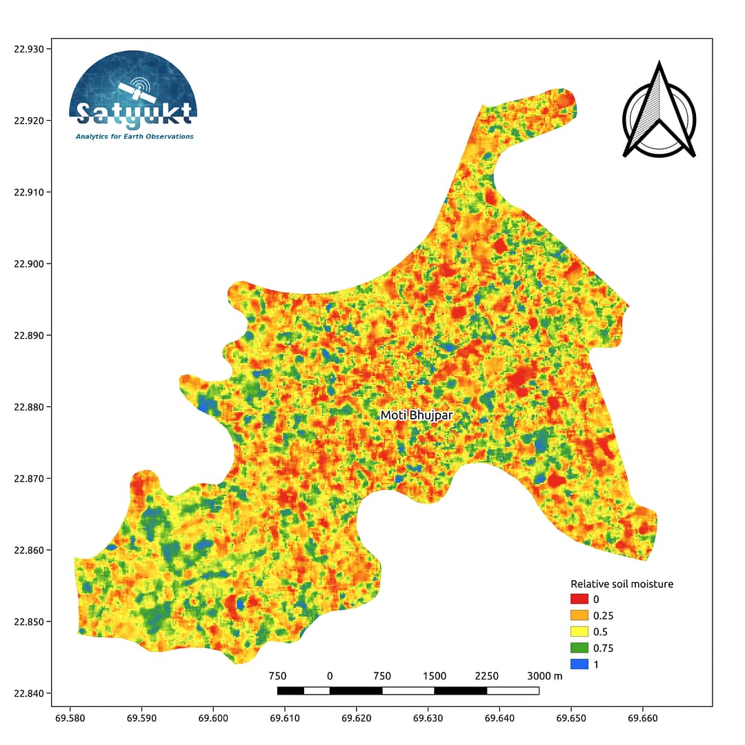
The above map shows the soil moisture map as on November 14, 2018, for a village in Gujarat. As it can be inferred from the map, even a slight variation in soil moisture is accounted. The map has been prepared by Satyukt Analytics Pvt Ltd as an attempt to make hydrologic data understandable to the public. The soil moisture is prepared by merging data from multiple satellites using the vikleda algorithm.
Some of the applications where soil moisture is useful are:
- Optimal irrigation in farms
- Identify areas being over-irrigated
- Improved flood risk estimation
- Monitor agricultural drought in near real-time
- Improved weather forecast
- Analyze the impact of an irrigation project
- Identify the irrigated area by an irrigation source
- Automatic billing of farm based on the actual irrigation
- Estimation of actual evapotranspiration taking place
- Estimation of area getting degraded
To watch your region in near real time, please check our service VATI


