
Soil moisture estimation using Sat2Farm application
Agriculture and its challenges:
Economic growth and development are heavily dependent on agriculture. It is essential to human existence because it provides food. The sector contributes a great deal to the economy as a supplier of industrial raw materials. It also contributes significantly to Gross Domestic Product (GDP). Human survival depends on it, and it is the world’s oldest occupation. Subsistence agriculture, overpopulation, monsoon dependence, seasonal patterns are some of the challenges Indian agriculture faces. The poor mechanization of farming, soil collapse, difficult soil moisture estimation, pests and diseases, and costly farm inputs are among other factors.
To overcome these challenges, farmers use new technologies to manage agricultural inputs and to increase the crop yields. Modern agriculture with digital technology makes farming more easy, exact, accurate and optimized. Precision agriculture, digital farming and smart farming serve as the basis to increase crop yields. And also save costs in the long-term, to overcome risks and to aim for sustainable agriculture.
Currently, the Indian government has initiated a Digital Agriculture Mission for 2021-25 for agriculture projects. This is based on new technologies such as artificial intelligence (AI), Machine Learning (ML), remote sensing and GIS technology.
AI and ML technology:
Today, Machine Learning (ML) and Artificial Intelligence (AI) are used interchangeably. It is a science that enables software applications to predict outcomes more precisely without explicit programming. The output is processed using historical data as input. Remote sensing data can thus be gathered from satellites for use as an input. Data from remote sensors provides a global perspective on Earth systems. Enable the management of our planet based on data-informed decisions. The farm can be monitored remotely and valuable insights can be gained. As a result, global satellite data is available in several wavelengths at higher spatial resolutions.
Soil Moisture:
Soil Moisture (SM) is generally referred to as the total amount of water in the soil. It is measured in terms of % water by weight, inches of water to inches of soil, % of saturation, and tension. It serves many purposes in deciding the crop growth and is the principal component of the growing plants. Drought or soil moisture stress is a major cause of crop loss in India. Measurement of optimum soil moisture required by the individual crop is essential to manage water/irrigation properly.
There are many ways of measuring soil moisture. Few include gravimeter method, electrical conductivity method, measurement by using tensiometers etc. But all these methods are time and resources consuming. However, the latest technologies are satellite remote sensing coupled with machine learning. They aid in soil moisture estimation easily without the need of manual intervention.
Accurate monitoring of soil moisture helps in efficient control of nutrients and other inputs. There is a provision for automated soil moisture tracking through modern crop monitoring technology. The processed data helps in maintaining required soil moisture throughout the cropping season.
Agricultural remote sensing and Satyukt Analytics
We have developed algorithms with AI/ML, agricultural remote sensing and big data analytics . Monitoring soil moisture can be done easily and regularly using these global scalable methods.
All this information is available through the smartphone application “Sat2Farm” (https://play.google.com/store/apps/details?id=com.satyukt.myfarmapp). It uses satellite imagery and guides the farmer in decision making, thus helps in proper irrigation management. Satellite soil moisture with weather forecast data are used to schedule irrigation. Satyukt Analytics is successful in providing irrigation advisory through Sat2Farm mobile app.

Advantages of Sat2Farm app based Soil Moisture Mapping
- A farm’s under/over irrigated area can be quantified.
- The estimate of soil moisture made is accurate, instantaneous, and readily available to the farmer.
- Easily accessible from remote locations, which will save the farmer time and money.
- Comparatively, the cost is lower than any other method.
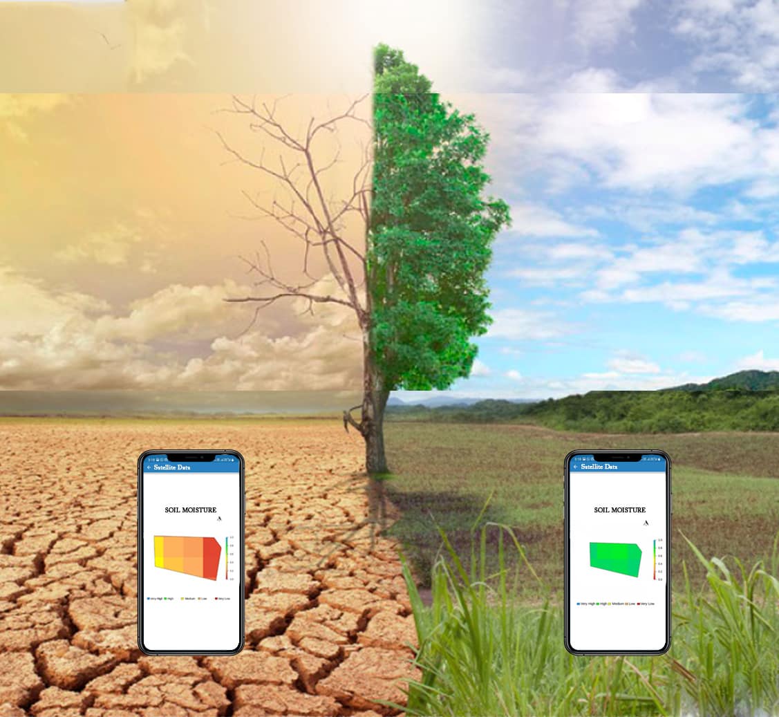
- The moisture content of your farm will be displayed in an easily readable manner with the color codes. This will help the farmer in decision making about irrigation management.
Case studies:
Here are some of the practical experiences shared by our farmers about their test results. Dr. Prabhudeva, Doctor residing in Bengaluru and having his farm in Thammenahalli, Ramanagara district. He has been using the Sat2Farm application since January 2022. The satellite data like crop health and soil moisture helps him guide his farm manager and supervise his farm better. Malfunctioning of a drip irrigation filter was one such incident. Just by looking at the abnormal soil moisture behavior, he was able to identify without visiting his farm . Also the analytics given along with it has helped him to optimize the irrigation water usage.
Farmer by name Rajneesh Kumar, Bijnor, Uttar Pradesh has been using this app since April 2021. With Sat2farm, he is able to monitor moisture levels in the soil and plan irrigation accordingly. He has used the features of this application with sugarcane, wheat, and mustard crops, which brought him good results.
Conclusion: Thus, Satellite based soil moisture estimation helps the farmers to know the potential surface water in their entire field. Hence helps to decide the type of crop that can be grown in the soil. It will direct the farmers in deciding the right time for irrigation and the right system to be used. For more information, reach out to us at connect@satyukt.com or +91 8749094434


