
Crop Yield Estimation
Crop yield determination plays a crucial role in maintaining a good amount of food security for the entire country. Reliable, accurate, and timely information is considered as primary inputs to the developers, stakeholders, and policymakers for computing effective agricultural policies, and for taking significant decisions with respect to storage, public distribution, import, export, and other related issues. Traditional practices for crop yield estimation are often time-consuming, costly, complicated, and they can not be run on a large scale. So, it is urgently required to adopt cheaper/faster ways for crop yield estimation. At Satyukt, we have developed a novel algorithm to estimate crop yield data. The algorithm is the combination of multiple satellite datasets to determine agro-hydrological data such as – soil moisture, NDVI, rainfall, and actual crop yield.
The following solutions we offer:
- Provide crop yield statistics at the regional level.
- Reduce the cost of collecting data
- Save the time of collecting data.
- Provide unbiased, transparent, and accurate data at a regional level.
- Provide insights into anomaly at the regional level.
- Provide global level data at any remote location.
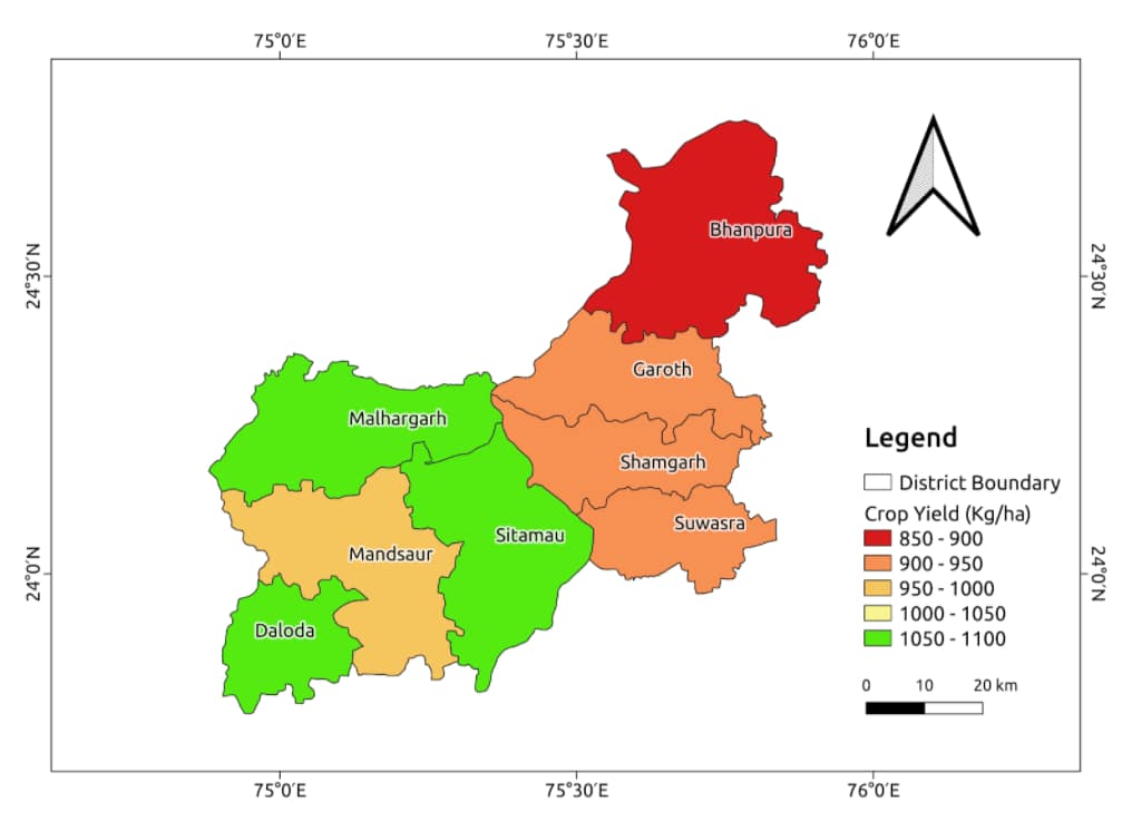
As an example, the above map represents the crop yield estimation for the Mandsaur district of Madhya Pradesh. The yield estimation is based on statistical models along with the satellite and historical crop yield data. Here, we can see Malhagarh, Sitamau, and Daloda provide a good amount of crop yield than other taluks of that district.


