
Flood Inundation Assessment of Assam
North-Eastern India used to get flooded every year during the monsoon season due to the increase in the level of the Brahmaputra river and its tributaries. There are several other reasons such as excessive sediment charge, continuous heavy rainfall, and the unstable nature of the Brahmaputra river, Assam faces multiple flood waves within a year. In order to handle this kind of situation, Satyukt provides you a pragmatic approach to assess flood hazards based on historical flood data. This helps in the management of the flood-prone area, insurance rating, and also prevents losses and damages caused by the flood. It is useful for various strategic decisions on crop insurance, agriculture, infrastructure development, and other sectors.
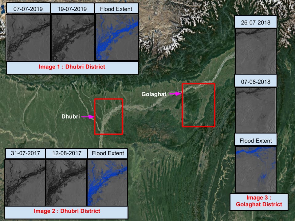
In this study, Sentinel-1 data is used to analyze and map the spatial extent of flood inundation of several districts of Assam. Flood assessment has been focused mainly on Dhubri district and Golaghat district as shown in the above image. Based on the analysis, it is found that the effect of the flood was more in 2017 as compared in 2019. The area near the river basin was badly affected in Golaghat in 2018.
Satyukt’s Macro portal provides access to flood-affected areas. To access the current and historical flood-affected area statistics contact us to register in our portal and to find out our pricing details at contact@satyukt.com. We will be happy to address all your queries. In the meantime, have a look at satyukt.com for more information about us.


