
High spatio-temporal resolution soil moisture : A welcome change
India has witnessed many natural disasters like floods, landslides, cyclones, forest fires, earthquakes, drought, etc. To comprehend risks due to such disasters, it is necessary to integrate satellite and field-based observations and to work towards risk reduction principles1. Satellites provide synoptic observations of the natural disasters at regular intervals that helps in better gearing up against disasters and its management. Remote sensing of soil moisture from the vantage point of space is advantageous because of its spatial coverage and temporal continuity.
Keeping a tab on the soil moisture conditions whether for hydrological studies or for; flood forecasting; agriculture; soil health; soil research; irrigation & optimisation; water conservation; and soil erosion research delivers important information for the protection of soil and water resources in the future.
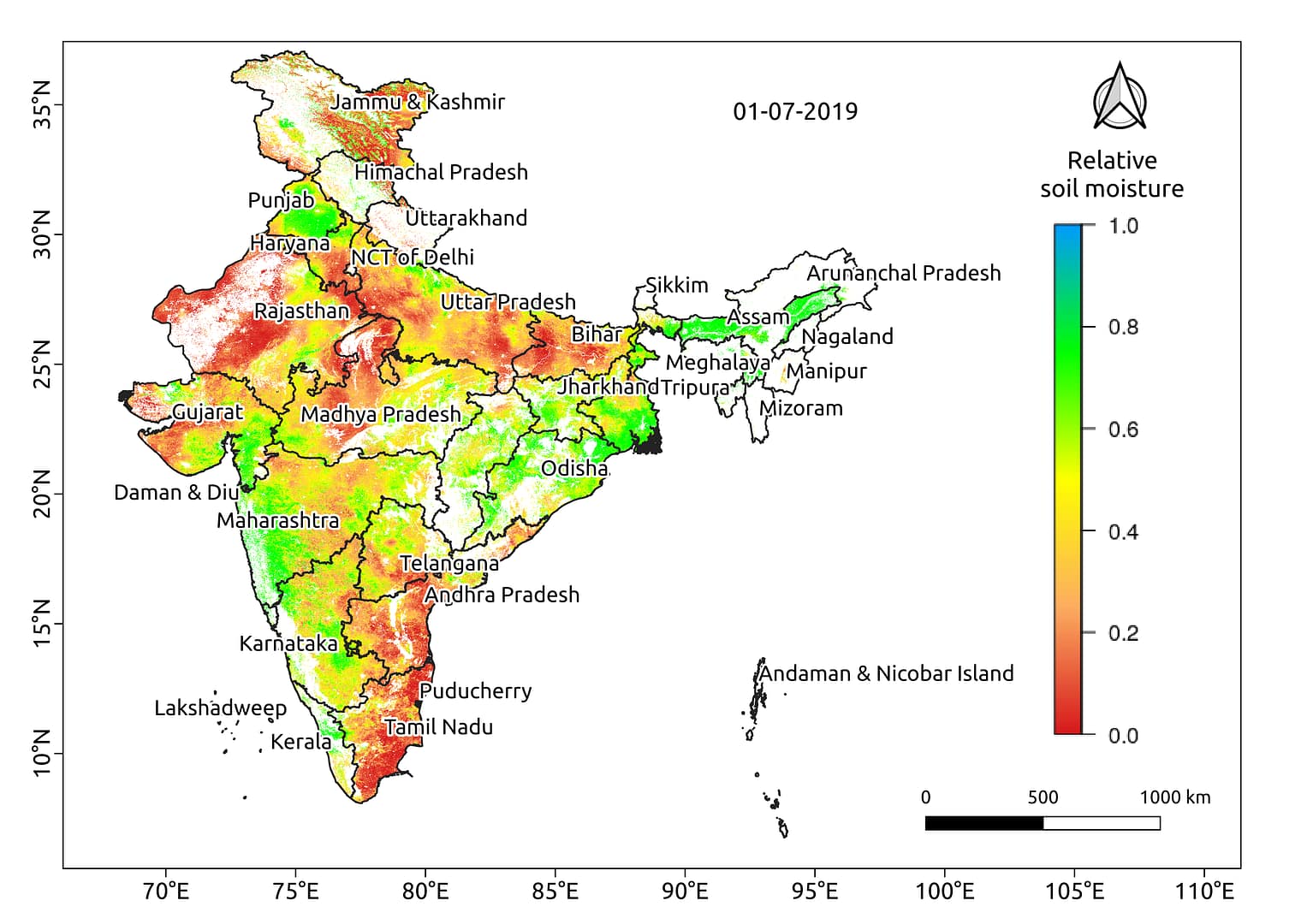
The above map of India prepared by Satyukt Analytics showcases the distribution of moisture, on 1st July 2019 using proprietary algorithm Merging Active and Passive microwave Soil Moisture (MAPSM) (Tomer et al., 2016)2 employing satellite sensed data in near real-time. Satyukt provides high spatio-temporal maps employing MAPSM and can deliver data in near real-time under all-weather conditions .


