
Landlocked Laos’ Dam Breach: Microwave remote sensing to aid flood management
First published on July 27, 2018
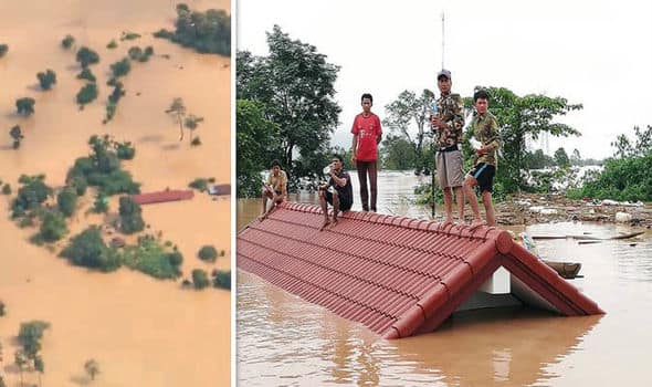
Laos ,situated in the banks of Mekong River and its tributaries forms the best place for Hydroelectric power projects. Hydroelectric power with an estimated capacity of 18,000 MW is the main resource of Laos and other parts of south east Asia.1 The recent dam collapse in the country had left half-dozen rural villages submerged in the water.The remote nature of the flooded place has been posing difficulty in flood assistance or management 2 . Hence it is crucial to identify flood affected areas in near real time so that government and other decision making agencies can plan rescue operations properly. Satellite remote sensing is capable of identifying flood affected areas. The following figure (Figure 1)shows the optical satellite imagery of the area before and after flooding.


As it can be seen from the above pictures that optical Satellite imagery hardly has any data as it was reportedly raining on the day above the normal range and hence optical imagery is not helpful in this case.Microwave remote sensing is capable of obtaining data under all weather conditions and hence can map flood affected areas to aid an effective rescue operation.Figure 2 shows microwave data over the area before and after flooding, where the dam and flooded areas can be seen clearly as microwave data is capable of penetrating clouds.


References Used
1 https://www.theguardian.com/world/2018/jul/25/laos-dam-collapse-3000-need-rescue-death-toll-rises
2 https://en.wikipedia.org/wiki/Laos


