
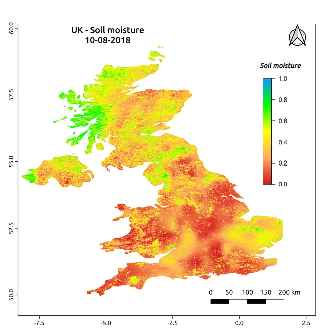
Less soil moisture over United Kingdom: A matter of concern for farmers
Most of the land (69%) in the United Kingdom is covered by agricultural land which employs 1.5 % of its workforce. Monitoring soil moisture is important as the agricultural sector contributes 0.62% of GVA of the country. The above soil moisture map has been prepared by Satyukt Analytics Pvt Ltd as an attempt to make hydrologic data understandable to the public. As evident from the map shown above, the country has relatively less soil moisture (on 10th August 2018). It may be a matter of concern for farmers.
The soil moisture is acquired by merging data from multiple satellites using the vikleda algorithm. Some of the applications where soil moisture is useful are:
- Optimal irrigation in farms
- Identify areas being over-irrigated
- Improved flood risk estimation
- Monitor agricultural drought in near real-time
- Improved weather forecast
- Analyse the impact of an irrigation project
- Identify the irrigated area by an irrigation source
- Automatic billing of farm based on the actual irrigation
- Estimation of actual evapotranspiration taking place
- Estimation of area getting degraded
To watch your region in near real time, please check our app VATI .


