
Satellite estimated Soil moisture: A comprehensive solution for many agricultural problems
Soil moisture, the water held within the soil pores in liquid or vapour phase is the major factor that supports plant growth. Plants can readily absorb water if the moisture content of the soil is optimum. Knowledge of spatiotemporal variation of soil moisture is of utmost importance as it helps in understanding the health of crops and can thereby predict soil agricultural yield.
Conventional way of measuring soil moisture is to install soil moisture sensors in the ground which measures the volumetric water content indirectly by using properties of the soil, such as electrical resistance, dielectric constant, or interaction with neutrons etc. But this method is time-consuming and has limited coverage. Hence a number of methodologies are developed globally utilizing the satellite data to retrieve relative soil moisture which provides a better coverage compared to the former method. Soil moisture data is provided by passive and active microwave sensors. Passive microwave sensors provide soil moisture globally at a coarser spatial resolution whereas active microwave sensors have higher spatial but low temporal resolution (2–4 weeks). Using soil moisture data directly from any of these sensors will have compromised spatial or temporal resolution. Satyukt Analytics Pvt Ltd has developed an innovative algorithm that merges data from active and passive microwave sensors to provide soil moisture with high spatial and temporal resolution. Some of the applications where higher spatiotemporal resolution soil moisture data is useful are:
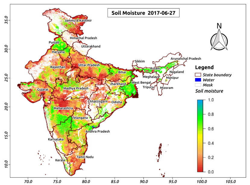
The above map shows the soil moisture for 6th July. As it can be inferred from the figure, the soil moisture is relatively low at most of the places in the country.
- Optimal irrigation in farms:
- Improved flood risk estimation:
- Monitor agricultural drought in near real time:
- Likely crop Yield:
- Irrigation Management:
- Improved weather forecast:
- Analyze the impact of an irrigation project:
- Identify the irrigated area by an irrigation source
- Automatic billing of farm based on the actual irrigation:
- Estimation of actual evapotranspiration taking place
- Estimation of area getting degraded:


