
Trend analysis reflects a decline in total precipitation in Telangana
Climatic changes may have drastic effects on Agricultural yield. The knowledge about the variation of these changes with time is of utmost importance as this helps to adapt different agricultural practices for the betterment of yield. The conventional way of measuring climatic change is by using precipitation and temperature data. The usage of this data is limited because of the difficulties in acquiring and analyzing the data. And this data obtained using conventional methods are not in near real time and hence will not be much useful for farmers. With the emergence of satellite sensors, many parameters influencing agricultural yield can be monitored and analyzed. Detecting how these parameters vary over time helps to predict the changes well before its occurrence and thus provides a possibility of preparedness without compromising on the yield.
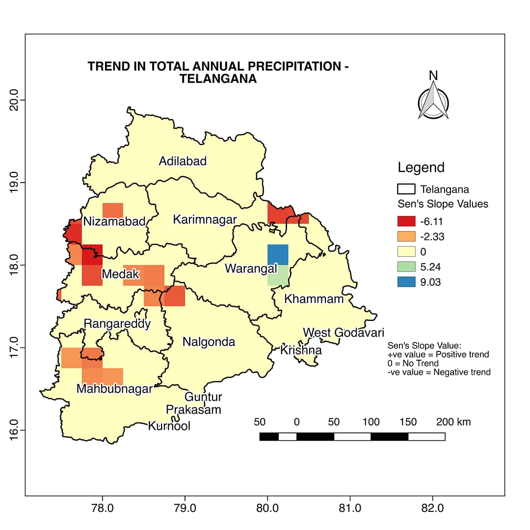
The semi-arid rainfed area of Telangana State is characterized by high variability in precipitation and runoff over space and time. The figure shows the trend of total precipitation of the state analyzed over a period of 65 years. The total precipitation is obtained using climdex model. Precipitation/Rainfall apart from being an intrinsic hydrologic component also plays a crucial role in supporting socioeconomic growth and food security. Rainfall properly monitored and analyzed can help in predicting Flash floods, Hydrological modeling, Crop forecasting, Landslide triggering, It is essential to improve climate/weather predictions.
The required spatiotemporal resolution of the satellite products used in the study is obtained by integrating multi-sensor data with an algorithm developed at Satyukt Analytics, as most of the satellite products have compromised spatial or temporal resolution.


