
Parched basin of Godavari river: Agriculture in a tight spot?
First published on September 11, 2018
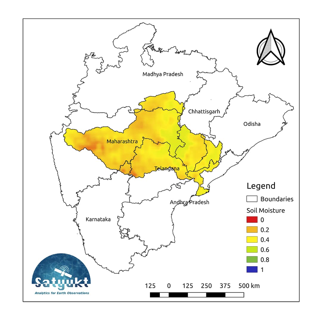
The Godavari river flows through the states of Maharashtra (48.6%), Telangana (18.8%), Andhra Pradesh (4.5%), Chhattisgarh (10.9%), Madhya Pradesh (10.0%), Odisha (5.7%), Karnataka (1.4%) and Puducherry (Yanam) and joins Bay of Bengal. The Godavari basin receives its maximum rainfall during the Southwest monsoon.1. The average soil moisture map for the month of September shows that the Godavari basin is relatively dry, which may be a matter of concern for farmers.
Passive microwave sensors provide soil moisture globally at a coarser spatial resolution whereas active microwave sensors have higher spatial but low temporal resolution (2–4 weeks). Using soil moisture data directly from any of these sensors will have compromised spatial or temporal resolution. Satyukt Analytics Pvt Ltd has developed an innovative methodology which merges active and passive microwave data to obtain soil moisture data of high spatiotemporal resolution. Some of the applications where this high-resolution soil moisture data would be useful are:
-
- Optimal irrigation in farms
- Improved flood risk estimation
- Monitor agricultural drought in near real time
- Likely crop Yield
- Irrigation Management
- Improved weather forecast
- Analyze the impact of an irrigation project
- Automatic billing of farm based on the actual irrigation


