
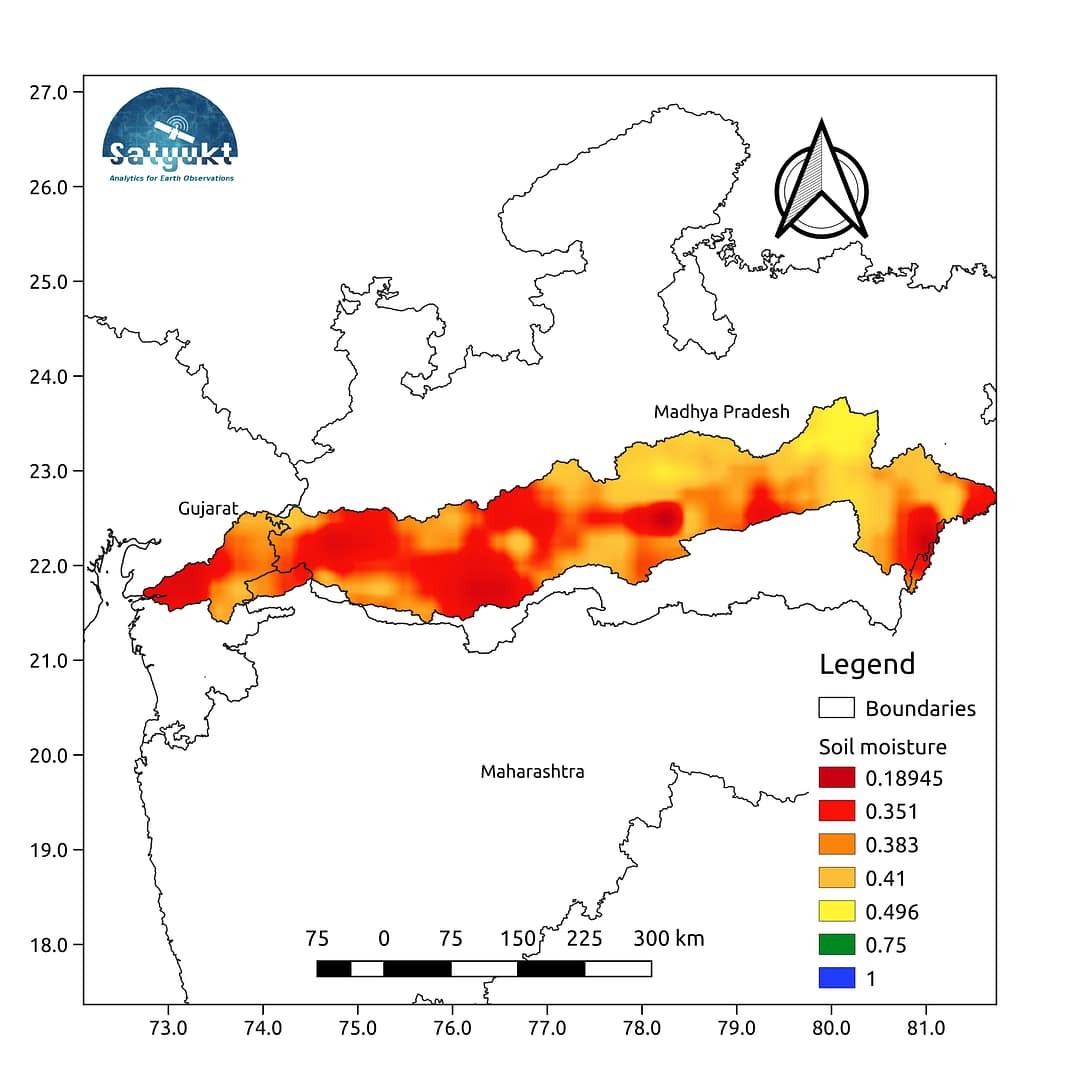
With 58% water depletion, the river Narmada is depleting at an alarming rate. The river serves as a major source of drinking water, irrigation, and hydroelectricity for the states of Madhya Pradesh and Gujarat. The average Soil moisture map for the month of September over the river basin of the Narmada river clearly shows...

First published on September 11, 2018 The Godavari river flows through the states of Maharashtra (48.6%), Telangana (18.8%), Andhra Pradesh (4.5%), Chhattisgarh (10.9%), Madhya Pradesh (10.0%), Odisha (5.7%), Karnataka (1.4%) and Puducherry (Yanam) and joins Bay of Bengal. The Godavari basin receives its maximum rainfall during the Southwest monsoon.. The average soil moisture map...

Cauvery basin, the one known for its bitter water dispute between the riparian states extends over states of Karnataka, Andhra Pradesh, Kerala, and the Union territory of Puducherry. The issue that dates back to the pre-independence times still stands unresolved due to the lack of access to historic hydrologic data and lack of research...

Krishna Basin extends over an area of nearly 8% of the total geographical area of the country. This large basin lies in the states of Karnataka, Telangana, Andhra Pradesh and Maharashtra. The Krishna basin receives its maximum rainfall during the Southwest monsoon.. The average soil moisture map for the month of October shows that...