
Moderate soil moisture over Cauvery basin: Will monsoon prove beneficial for farmers?
Cauvery basin, the one known for its bitter water dispute between the riparian states extends over states of Karnataka, Andhra Pradesh, Kerala, and the Union territory of Puducherry1. The issue that dates back to the pre-independence times still stands unresolved due to the lack of access to historic hydrologic data and lack of research 2.
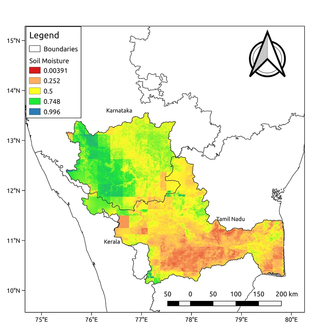
The above map shows the average relative soil moisture for the monsoon (from July to September). The map has been prepared by Satyukt Analytics Pvt Ltd as an attempt to make hydrologic data understandable to the public. As evident from the map shown above, the Cauvery basin has moderate soil moisture which may be an indicator of good agricultural yield. The soil moisture is prepared by merging data from multiple satellites using the vikleda algorithm.
Some of the applications where soil moisture is useful are:
- Optimal irrigation in farms
- Identify areas being over-irrigated
- Improved flood risk estimation
- Monitor agricultural drought in near real-time
- Improved weather forecast
- Analyze the impact of an irrigation project
- Identify the irrigated area by an irrigation source
- Automatic billing of farm based on the actual irrigation
- Estimation of actual evapotranspiration taking place
- Estimation of area getting degraded
To watch your region in near real time, please check our service VATI


