
Moderate soil moisture over Krishna Basin: Agricultural growth on cards?
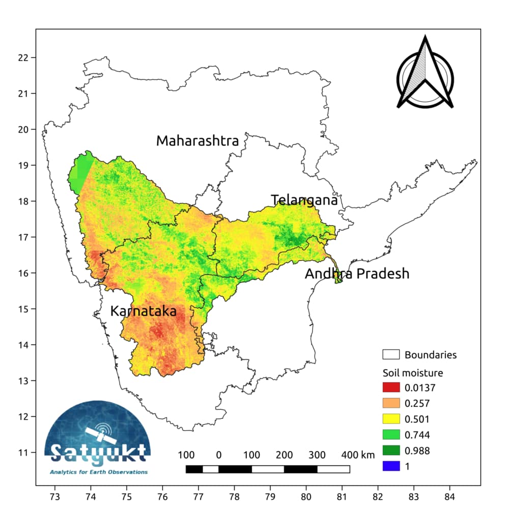
Krishna Basin extends over an area of nearly 8% of the total geographical area of the country. This large basin lies in the states of Karnataka, Telangana, Andhra Pradesh and Maharashtra1. The Krishna basin receives its maximum rainfall during the Southwest monsoon.2. The average soil moisture map for the month of October shows that the basin area is relatively dry, which may be a matter of concern for farmers.
The above map shows the average relative soil moisture for the month of October. The map has been prepared by Satyukt Analytics Pvt Ltd as an attempt to make hydrologic data understandable to the public. As evident from the map shown above, the Cauvery basin has moderate soil moisture which may be an indicator of good agricultural yield. The soil moisture is prepared by merging data from multiple satellites using the vikleda algorithm.
Some of the applications where soil moisture is useful are:
- Optimal irrigation in farms
- Identify areas being over-irrigated
- Improved flood risk estimation
- Monitor agricultural drought in near real-time
- Improved weather forecast
- Analyze the impact of an irrigation project
- Identify the irrigated area by an irrigation source
- Automatic billing of farm based on the actual irrigation
- Estimation of actual evapotranspiration taking place
- Estimation of area getting degraded
To watch your region in near real time, please check our service VATI


