Increasing Organic Farm Income Using Satellite Remote Sensing
To easily access and visualize the satellite data over any farm on the globe.


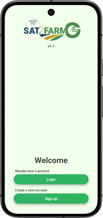
Sat2Farm Green is a mobile and web application
that supports organic farming with real-time insights for healthier crops and sustainable yields.
- User friendly
- Real-time data
- Global accessibility
- Accurate and efficient
- Comprehensive reports
Sat2Farm Green Features.
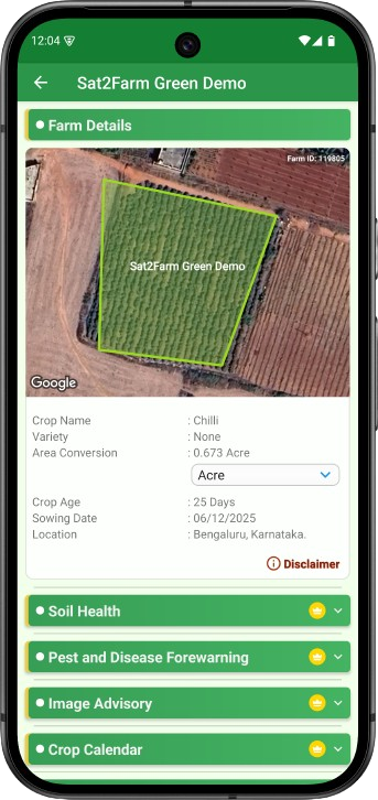
Soil Health- Satellite-based soil testing
Get NPK, pH and SOC through satellite based soil test report
Sat2Farm Green makes soil testing faster and easier by providing instant insights into key macronutrients. Farmers can quickly spot nutrient deficiencies and apply natural, organic inputs to restore soil balance. This helps improve nutrient uptake, strengthens crop health, and leads to better, more sustainable yields.
Pest and Disease Forewarning
Real time forecasts of crop pests and diseases.
Escape from severe crop loss due to pest attack. Sat2Farm Green alerts farmers to potential pest and disease outbreaks by tracking humidity, temperature, and other crop conditions. It recommends effective organic treatments, helping farmers prevent damage and manage threats naturally.
Weather Forecast
Stay updated on 14-day weather forecast data with the Sat2Farm Green app.
Receive a 14-day weather forecast to plan your farming activities, such as sowing, irrigation, and harvesting, more effectively.
Crop calender
Boost your yields, streamline planning, and enhance efficiency at your fingertips with the Sat2Farm Green crop calendars.
Sat2Farm Green’s Crop Calendar offers localized guidance on the best times for planting, harvesting, and managing crops. It provides recommended organic practices for each stage, helping farmers plan timely operations and use natural inputs like organic manures, vermicompost, and cow dung effectively. This supports healthier crops while reducing resource waste and maintaining soil fertility.
Irrigation Advisory
Satellite-based precise irrigation advisory.
Sat2Farm Green helps farmers use water efficiently for sustainable organic farming. It identifies soil moisture levels and provides timely irrigation advice to maintain healthy crops. By guiding farmers on when and how much to irrigate, it reduces water waste and ensures better yield from every drop.
Soil Moisture (SM)
Satellite-based soil moisture estimation.
Sat2Farm Green helps farmers track soil moisture changes over time to spot patterns and plan irrigation wisely. It provides moisture data for each part of the field, helping prevent crop stress and avoid overwatering. With real-time soil moisture insights, farmers can see which areas are dry and which are well-watered, ensuring efficient water use and healthier crops.
Image Advisory
Instant identification of pests and disease infestation.
Sat2Farm Green’s image advisory helps farmers manage pests naturally while reducing chemical use. Through the app’s camera feature, farmers can upload images of affected plants and receive quick guidance. It helps identify infestations accurately and suggests organic solutions such as cow dung, panchagavya, and neem-based preparations, protecting both crop yield and quality
LSWI (The Land Surface Water Index)
Satellite-based LSWI estimation.
This index helps track changes in the water content of soil and vegetation, especially during the early growing stages. With Sat2Farm Green, farmers can monitor LSWI levels over time to understand soil moisture trends and manage irrigation more effectively.
Crop health monitoring
Find how crops are growing on your farm remotely using satellite-derived NDVI
Sat2Farm Green helps farmers monitor crop growth remotely using satellite-based NDVI data. It tracks crop health, identifies problem areas early, and allows farmers to focus on the parts of the field that need the most attention, saving time and improving productivity.
Sat2Farm Green Gallery