AGRI-COMMERCE PLATFORM FOR ALL THE AGRICULTURE STAKEHOLDERS
Transforming crop cultivation with satellite technology


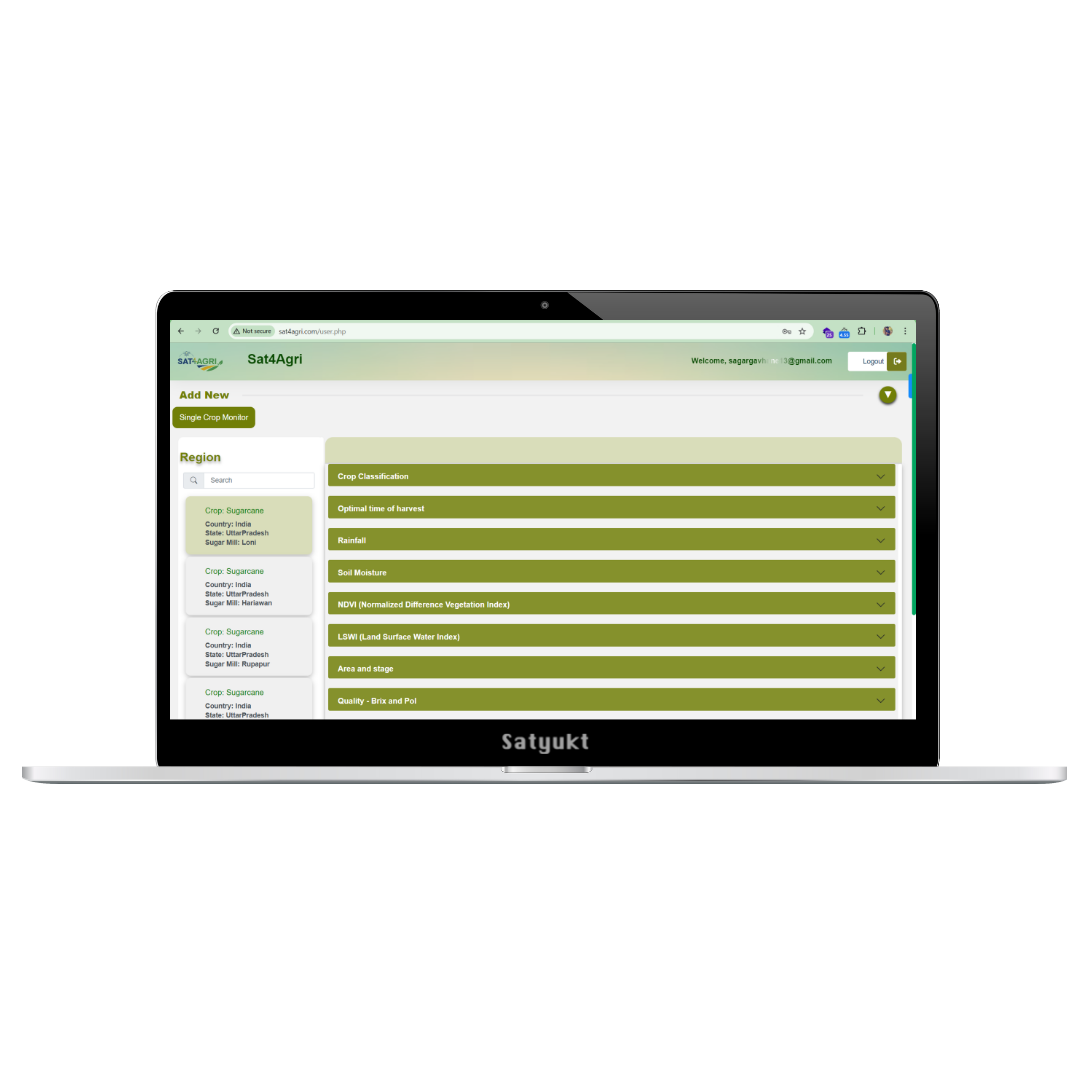
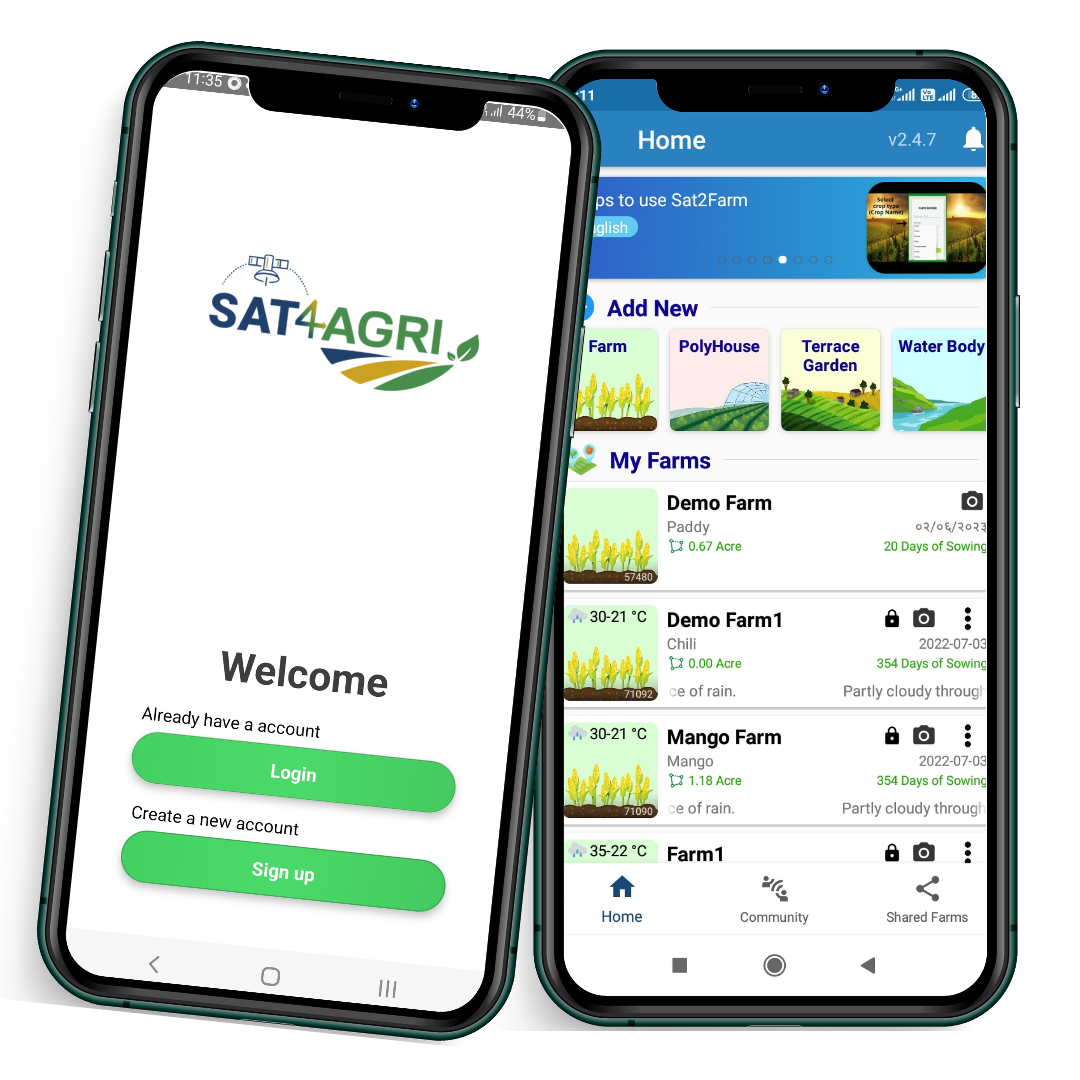
Sat4Agri is a web application
Which revolutionizes farming by integrating advanced satellite technology, delivering precision, real-time data, and enhanced management capabilities to crop cultivation, benefiting farmers and agricultural enterprises worldwide.
- Large scale accessibility
- Optimized use of resources
- Detailed reports
- Accurate estimation
- Improved crop management
Sat4Agri Features.
Crop stage analysis
Tracking crop conditions across growth stages for informed farming decisions!
This temporal monitoring allows for the observation of the progression of crop growth stages. Understanding events like flowering, fruiting, and ripening helps farmers schedule activities like harvesting at the most appropriate times, ensuring optimal product quality and yield. This enables an understanding of the growth stages of crops on a broader scale.
Crop acreage estimation
Precision acreage estimation for reliable agricultural insights.
Sat4Agri offers accurate crop acreage estimation, providing essential data on the extent of agricultural land under cultivation.
Crop health monitoring
Visualize your crop health data at a major scale with ease.
Our platform Sat4Agri utilizes satellite remote sensing technology that penetrates farmland barriers, accurately detecting the extent of damage to specific crops. Receive detailed reports outlining the exact percentage of a specific crop that has been compromised, empowering you to make data-driven decisions swiftly.
Agricultural crop classification
Identifies different crop types grown in a village or taluka or district or at any regional level.
Sat4Agri is a valuable tool for precisely assessing the variety of crops cultivated within defined geographic areas, be it individual villages, taluks, or entire districts.
Soil health analysis
Macro-level insight into soil health is provided by Sat4Agri.
Sat4Agri offers a comprehensive data on the overall condition of agricultural soil. It provides information about the essential macronutrient levels (NPK) in the soil along with SOC and soil pH. This remote sensing precision technology minimizes the need for traditional soil sampling, saving time and resources

Soil moisture estimation
Harnessing satellite data to monitor soil moisture and combat agricultural drought!
By integrating satellite data into agricultural management strategies, we can proactively address drought challenges and implement targeted cloud seeding measures in key regions, ensuring a more resilient and sustainable approach to safeguarding crop yield and water resources.
Crop yield estimation
Predicting Crop Yields with Precision and Insight.
Sat4Agri leverages advanced technology to accurately estimate crop yields, empowering farmers and agriculture stakeholders with vital insights for optimal harvest planning and resource management.
Sat4Agri Gallery
Advantages of Sat4Agri
The advantages of Sat4Agri are not limited to just the farmers but extend to the entire agricultural ecosystem. It empowers policymakers, researchers, and agricultural extension workers with data-driven insights to make informed decisions.
Learn MoreOur Mobile App is Coming Soon!
Stay tuned for something amazing. Our app will be available on both iOS and Android platforms.