INCREASING FARM INCOME BY USING SATELLITE REMOTE SENSING
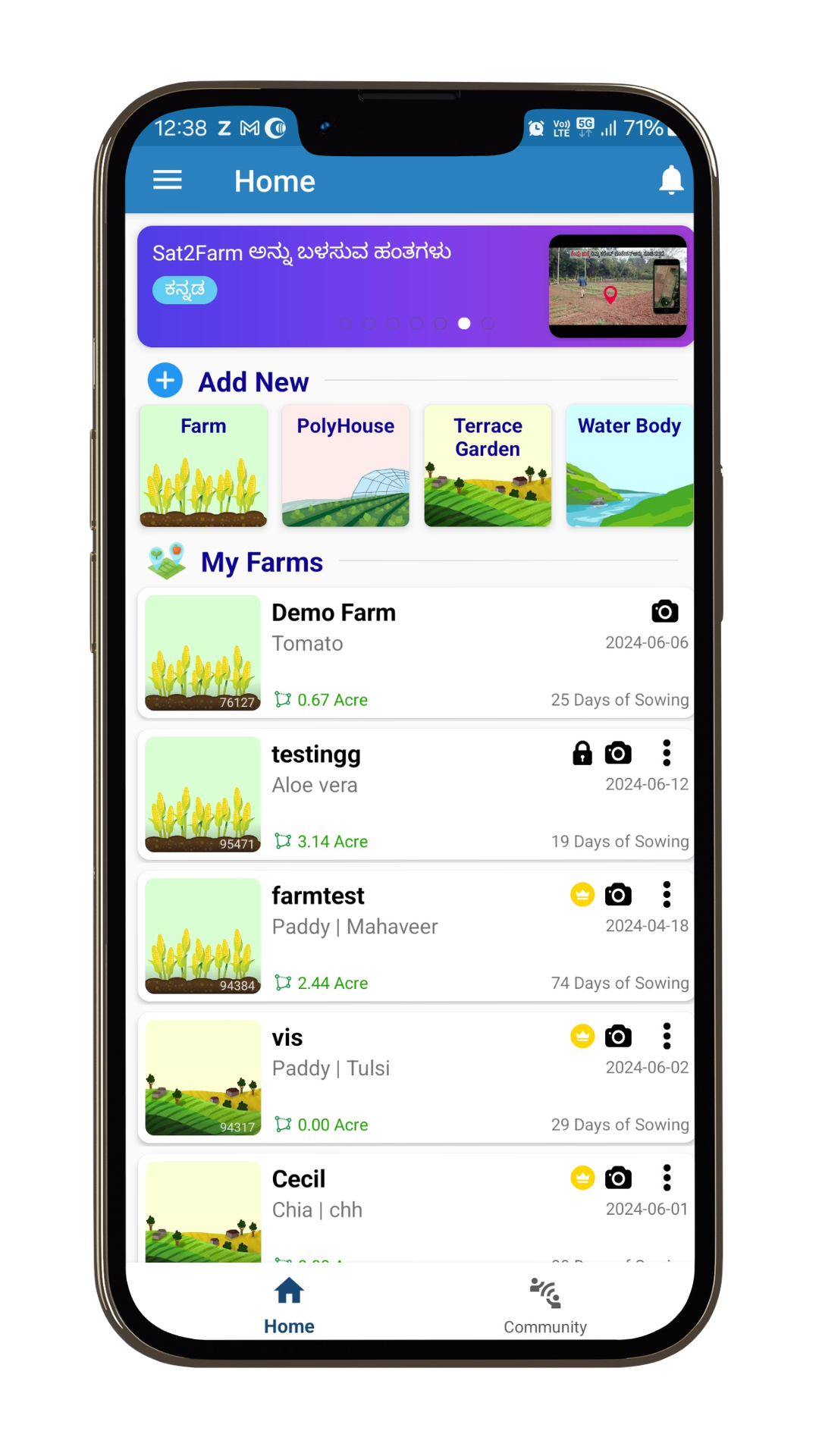
To easily access and visualize the satellite data over any farm on the globe.


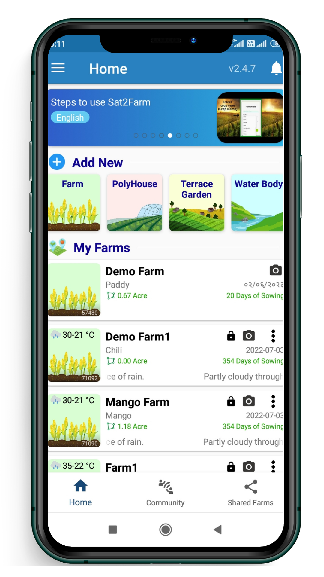
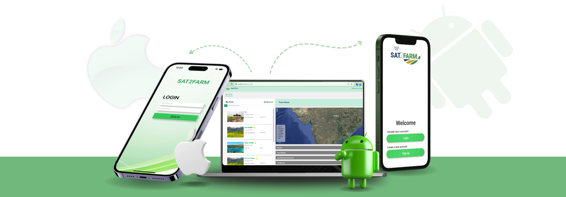
Sat2Farm is a mobile and web application
which revolutionizes farming by providing real-time precision farming information to farmers and agricultural enterprises.
- User friendly
- Real-time data
- Global accessibility
- Accurate and efficient
- Comprehensive reports
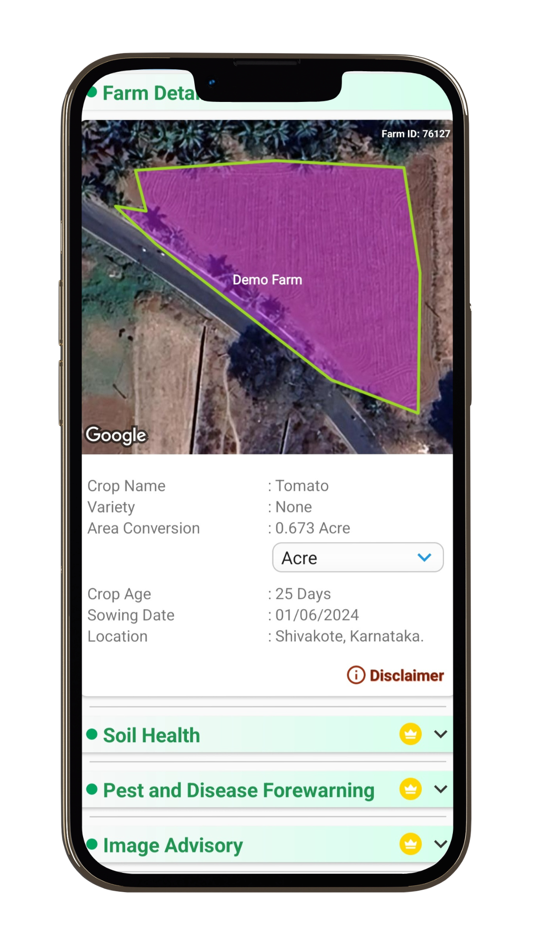
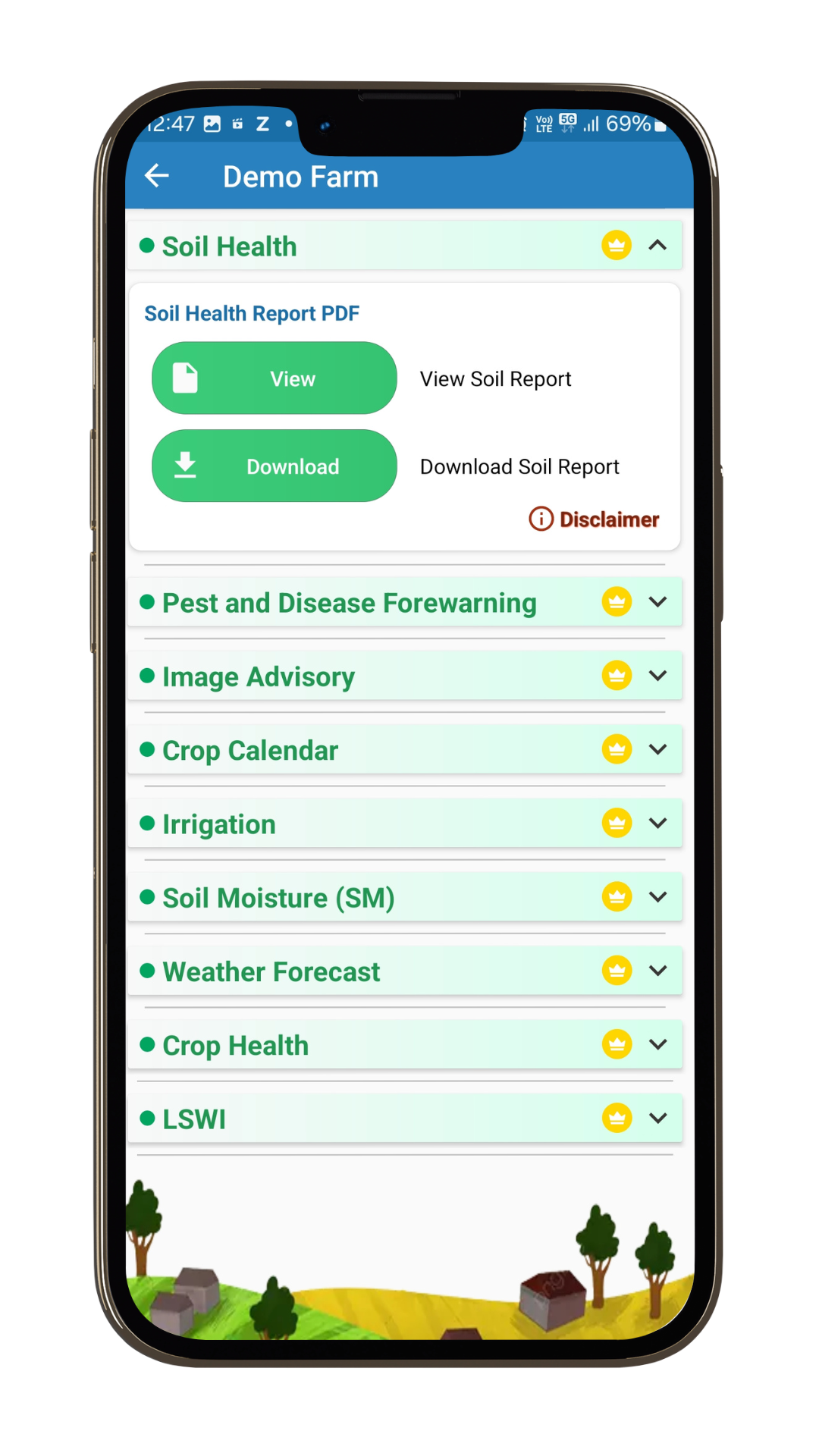
Sat2Farm Features.
Soil Health- Satellite-based soil testing
Get NPK, pH and SOC through satellite based soil test report
Sat2Farm simplifies and speeds up the process of soil macronutrient testing, providing farmers with immediate and accessible results. This enables quick identification of nutrient deficiencies and effective solutions to enhance nutrient uptake in crops, ultimately boosting overall crop yield.
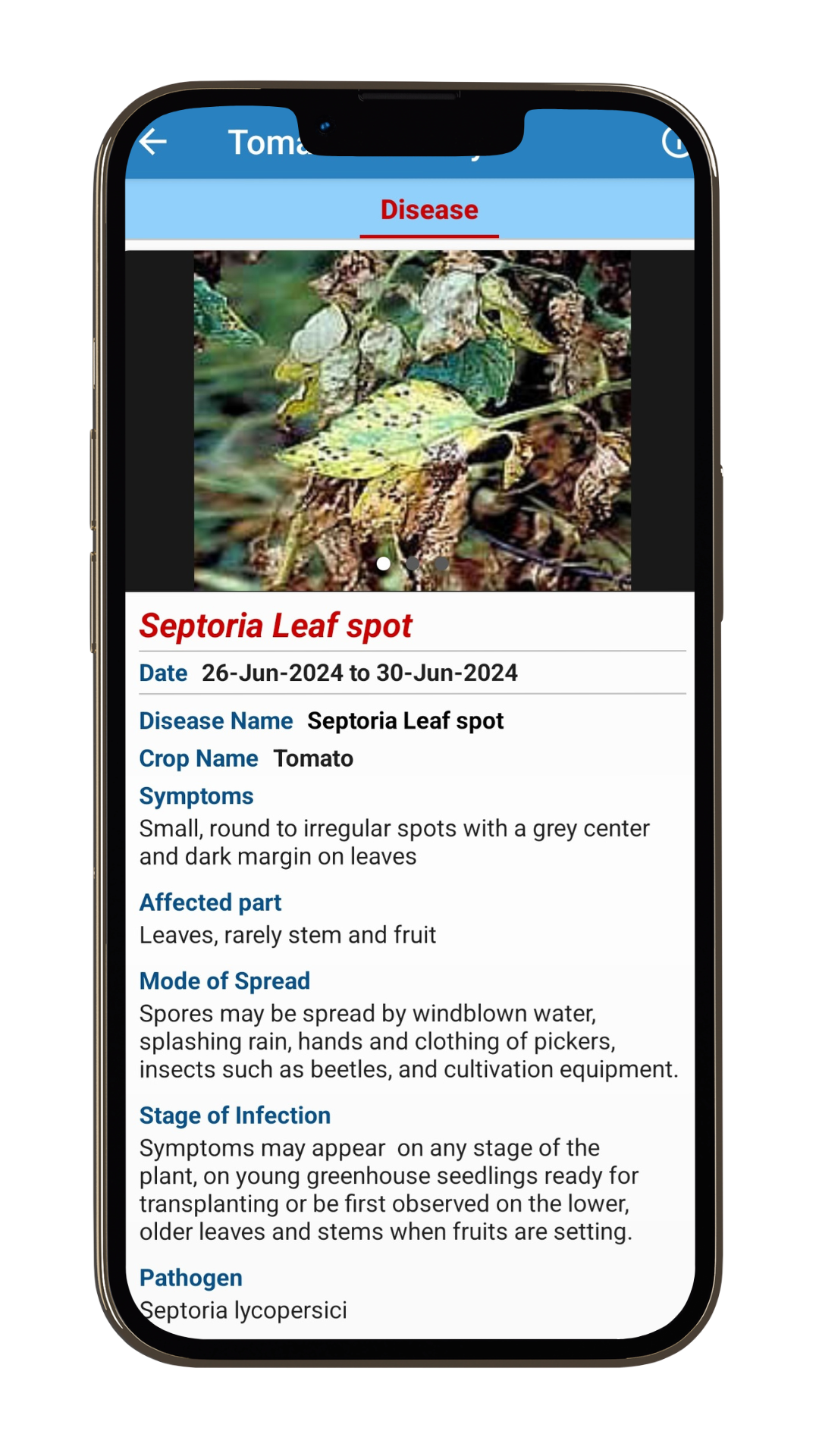
Pest and Disease Forewarning
Real time forecasts of crop pests and diseases.
Escape from severe crop loss due to pest attack. Sat2Farm provides farmers with warnings of potential pest or disease outbreaks based on factors such as relative humidity, temperature, and other agronomic parameters and suggests suitable control measures. This feature enhances farmers' preparedness to handle potential pest and disease threats effectively.
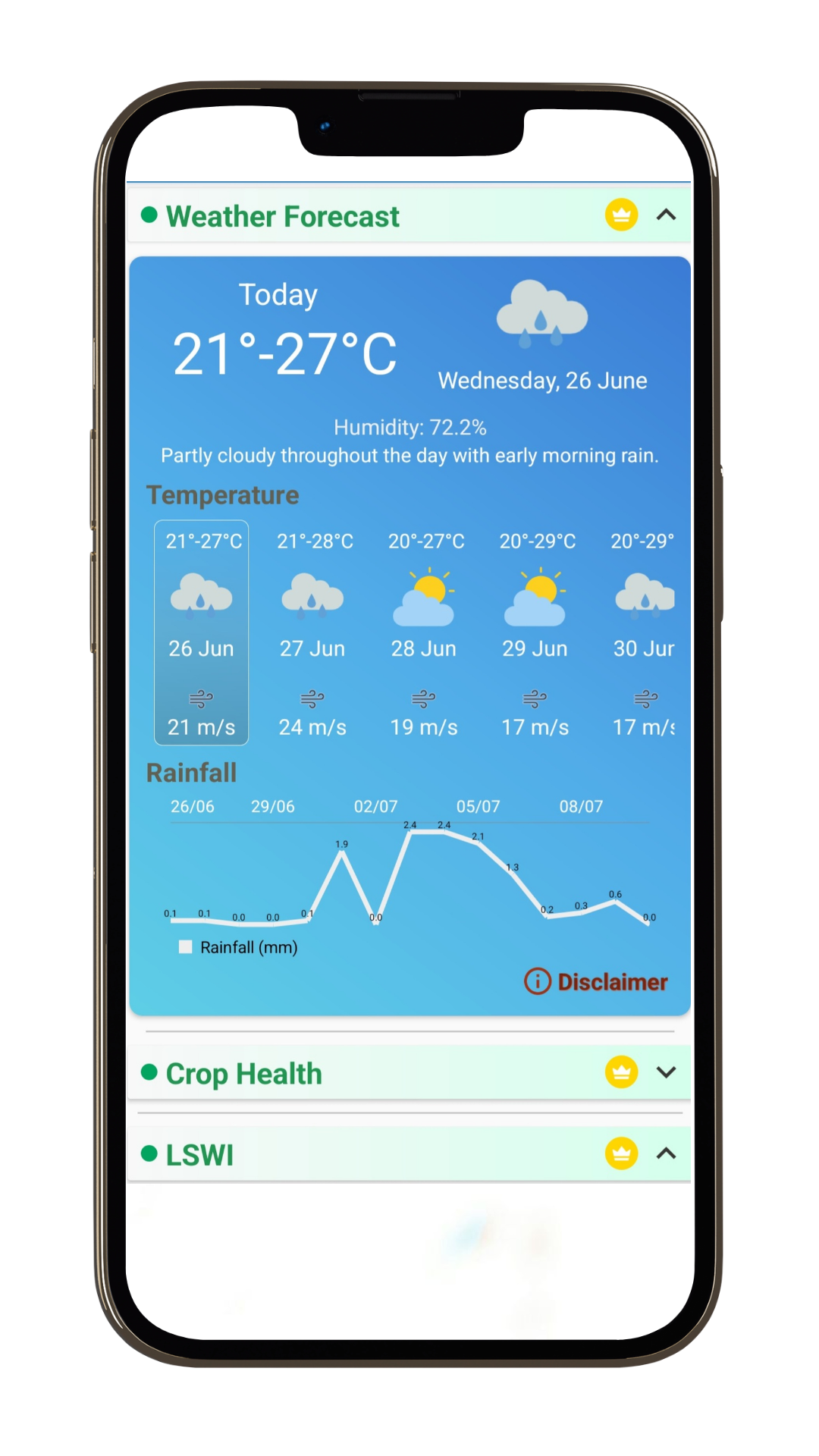
Weather Forecast
Stay updated on 14-day weather forecast data with the Sat2Farm app.
Receive a 14-day weather forecast to plan your farming activities, such as sowing, irrigation, and harvesting, more effectively.
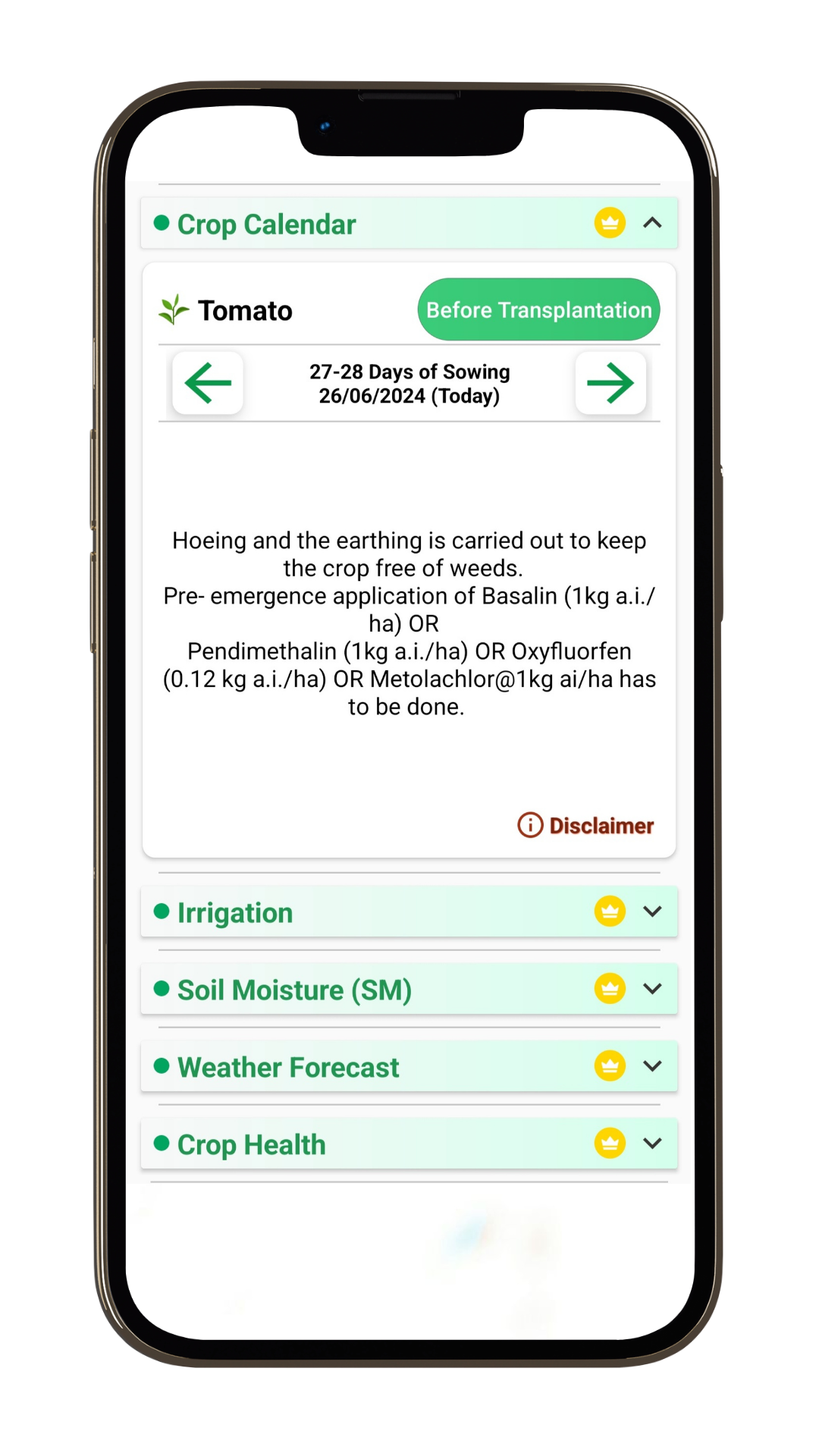
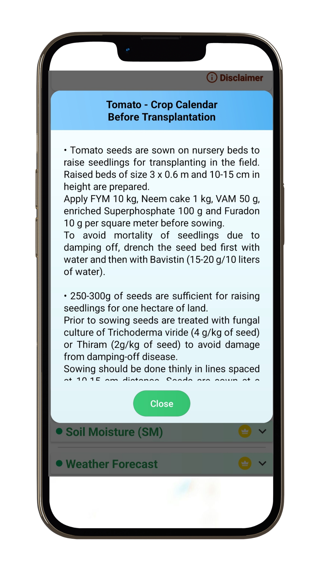
Crop calender
Boost your yields, streamline planning, and enhance efficiency at your fingertips with the Sat2Farm crop calendars.
Sat2Farm Crop Calendar feature provides comprehensive, localized guidance on optimal planting, harvesting, and maintenance schedules for your crops. Specific and recommended packages of practices are available at all times for each crop, ensuring timely farm operations and reducing the risk of overusing valuable resources like inputs, irrigation water, pesticides, and fungicides.
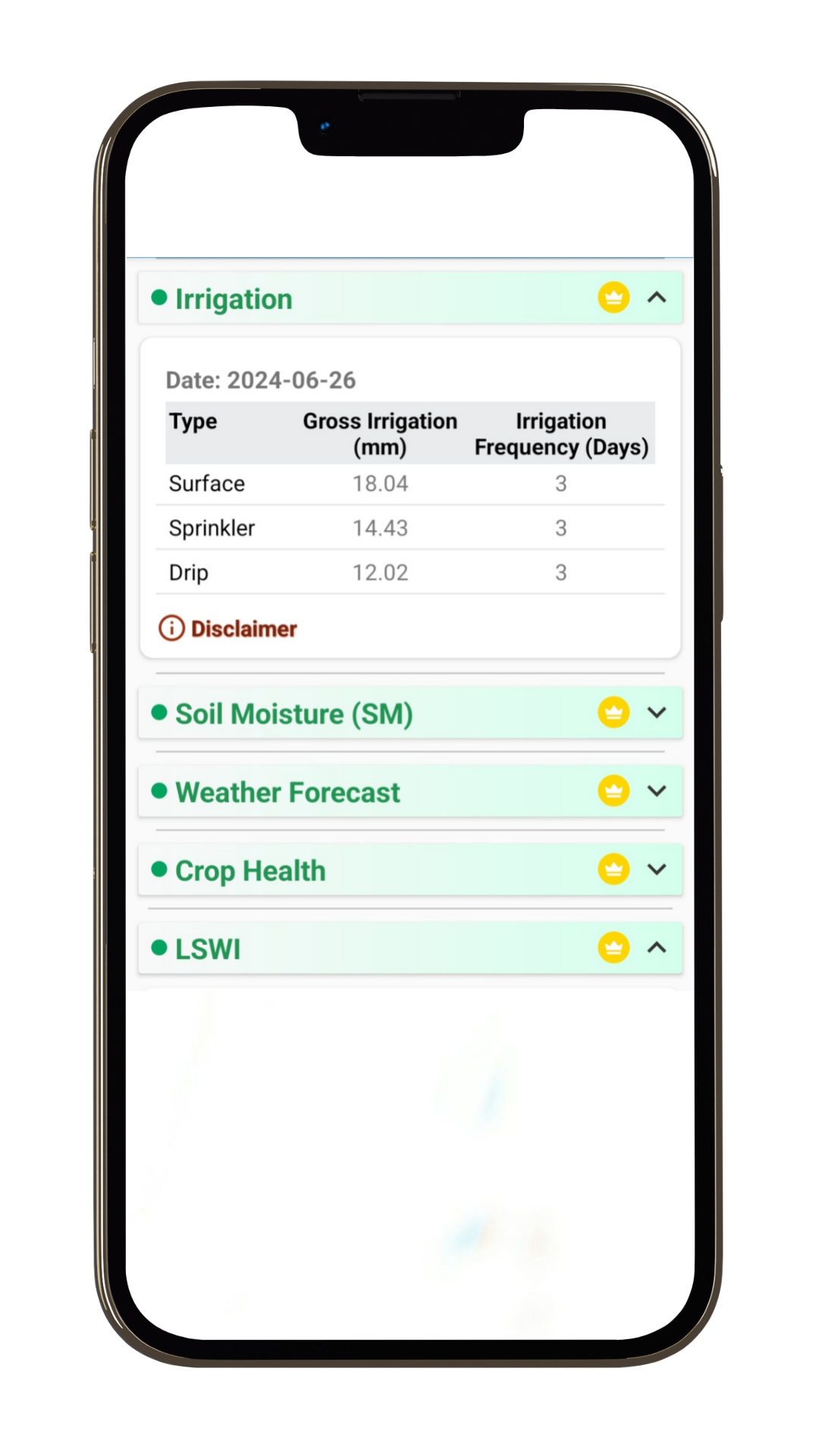
Irrigation Advisory
Satellite-based precise irrigation advisory.
Optimize water usage for efficient and sustainable farming. The Sat2Farm system determines whether a particular soil is moisture deficient and helps plan irrigation needs to achieve satisfactory yields. The irrigation advisory not only aids farmers in planning their irrigation requirements but also minimizes water wastage, ensuring more yield per drop of water used.

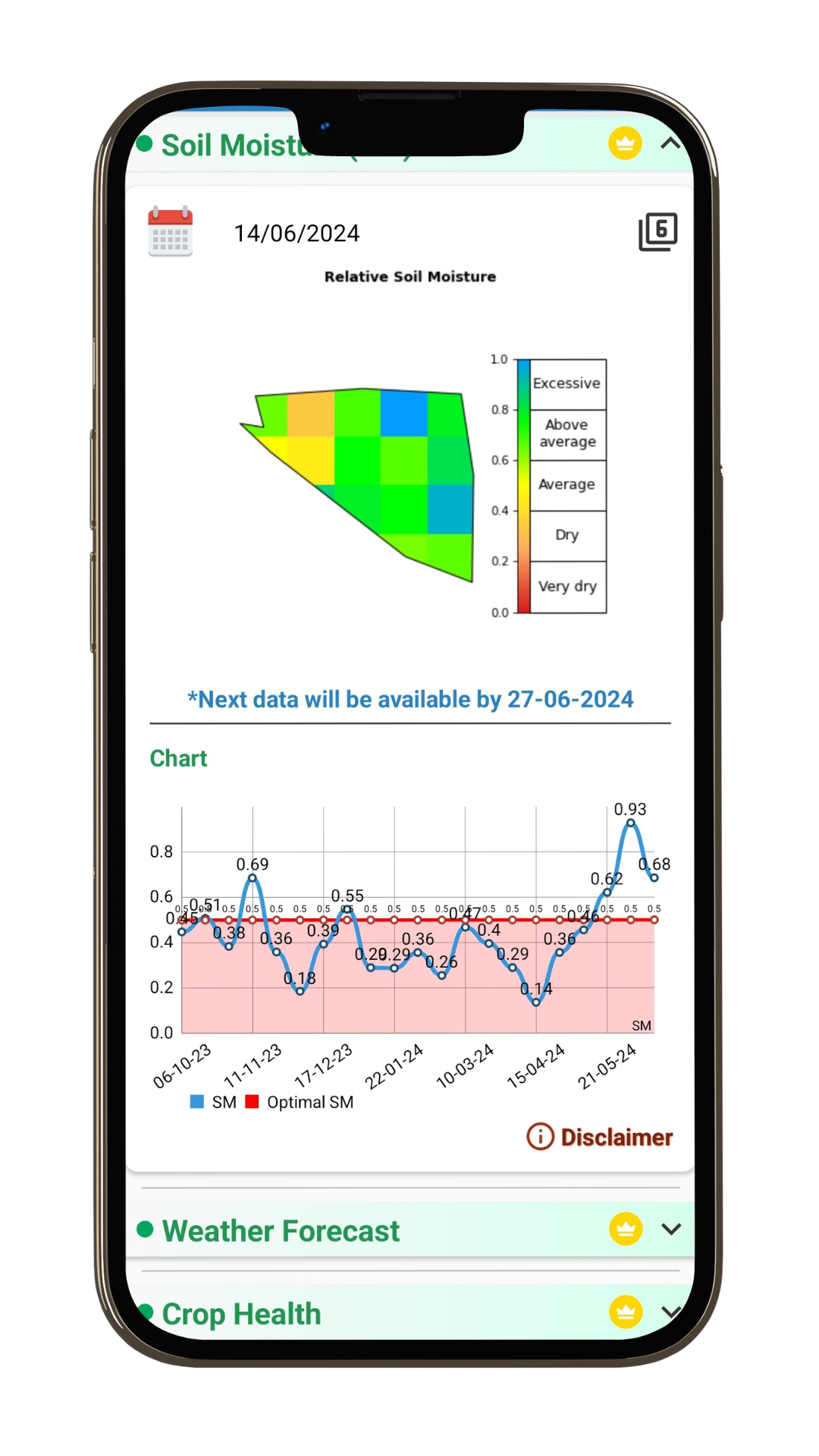
Soil Moisture (SM)
Satellite-based soil moisture estimation.
Track changes in soil moisture over time to identify patterns and trends using Sat2Farm.This feature helps farmers understand the moisture levels in each guntas of their farm, allowing them to plan their irrigation schedule before crops experience moisture stress. This ensures water savings by avoiding unnecessary or excessive irrigation. Based on real-time soil moisture information, you can accurately determine which areas of the land are experiencing dry conditions and which parts are saturated with moisture.
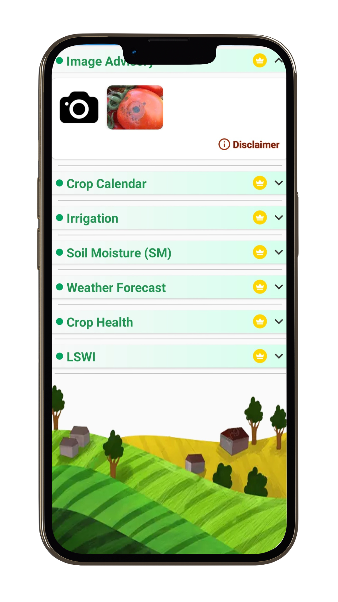
Image Advisory
Instant identification of pests and disease infestation.
Sat2Farm's precise image advisory aids targeted pest control, cutting down on pesticide overuse and curbing disease spread effectively. With the camera feature in the application, farmers can upload images of affected plant parts and receive timely advice. This helps them accurately identify the type of infestation or infection and obtain information on the appropriate pest and disease control measures, preventing significant loss in yield and quality of the produce.

LSWI (The Land Surface Water Index)
Satellite-based LSWI estimation.
This index is used to track changes in the liquid water content of soil and vegetation, especially in the early part of the season. You can observe the LSWI content of your farm over time.
Crop health monitoring
Find how crops are growing on your farm remotely using satellite-derived NDVI
Monitor crop health in your farms using indices like NDVI to precisely identify problem areas, allowing you to focus on the most critical issues rather than scouting the entire field.
Sat2Farm Gallery


Lets watch our Happy Farmer Interaction
HOW TO USE
Watch the video tutorial in your preferred regional Language to
know how to use Sat2Farm